










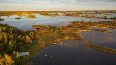
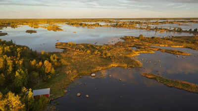
For thousands of years, Finland’s western shoreline has been quietly changing shape. Ground that was once pressed beneath an enormous sheet of ice is still rising, pushing parts of the coast farther out into the Gulf of Bothnia. To the eye, the process can look like nature simply adding more land. For waterfront property owners, however, the reality is more complicated: newly exposed ground does not automatically become an extension of the property behind it. According to an online report by ECONews, during the last ice age, the enormous weight of the Scandinavian ice sheet pushed the land downward by more than 500 meters in parts of the region. When the ice retreated more than 10,000 years ago, the Earth’s crust began a slow rebound. The process, known as post-glacial rebound, continues today.According to the news, Finland’s National Land Survey says the fastest uplift occurs around Kvarken, where the land rises by almost one centimeter a year. In southeastern Finland, the rate is less than three millimeters annually. NASA estimates that around the Gulf of Bothnia, about 700 hectares, or roughly 1,730 acres, of land emerges from the water each year. The figure gives a sense of the scale of the transformation, although it does not mean an individual property is gaining land at anything close to that rate. And the National Land Survey estimates that as much as another 100 meters of uplift could still occur near the Gulf of Bothnia.
New land does not automatically belong to the nearest owner
The legal situation becomes particularly interesting when the rising ground appears directly in front of a waterfront property. In Finland, land that was once covered by water but has become dry is known as vesijättö, commonly translated into English as a reliction area. It can form because of land uplift, falling water levels or the gradual overgrowth of waterways. The ownership of that land does not automatically shift to the person whose property happens to sit closest to it. In many cases, ownership remains with whoever owned the original water area. That can mean the newly exposed ground belongs to several property owners collectively through a jointly owned water area, often organized as an osakaskunta. In other words, the landscape can change without the property register changing with it.
The shoreline can move while property boundaries stay put
According to the report, that distinction can have practical consequences. A cottage that once stood directly beside the water may eventually have a stretch of dry land between its boundary and the shoreline. The owner may still have the same property they always had, even though the coast looks very different. Finland’s National Land Survey makes clear that natural changes do not automatically alter property boundaries. The location of the waterline is therefore not, by itself, proof of who owns the ground between a property and the sea. The issue is hardly new. Records from Östhammar, Sweden, describe complaints dating back to 1491, when the retreat of the shoreline had made the town’s old harbor unusable.
Owners can seek to acquire the emerging land
Waterfront owners are not necessarily left without an option. An eligible property owner can apply to acquire adjacent reliction land through a formal redemption process administered by the National Land Survey. A surveyor assesses whether the land qualifies, determines its value and establishes the compensation to be paid. Once the process is completed, the resulting information is recorded in the property register. The agency estimates that the procedure takes around seven months, although individual cases can take longer. Winter conditions can also delay fieldwork. There are costs involved. Current guidance puts the average procedural cost for a cottage plot at roughly €2,000 to €3,000. That amount covers the procedure itself and does not include compensation to the existing landowner or any applicable taxes.
A changing coast requires a closer look at the property line
For people living along Finland’s western coast, the lesson is straightforward. A changing shoreline does not necessarily mean a changing property boundary. Before building a dock, extending a yard or carrying out other work on newly exposed ground, property owners need to establish exactly where their legal boundary lies and whether a reliction area exists in front of it. The broader geological story also comes with an important qualification. Rising land is not the same thing as falling sea levels. Future changes along the Gulf of Bothnia will depend partly on how continued land uplift interacts with rising global sea levels.For now, Finland offers a striking example of how slowly moving geology can have very practical consequences. The ice age may be long gone, but its effects are still reshaping the coastline, and creating new questions about where nature ends and property ownership begins.Image Courtesy: ECONews